Showing posts with label GPS research. Show all posts

10.2.14

Welcome to Social Imaging


The central element of this site is my PhD related work. I'm really interested in how network science, urban planning and social capital research can be woven together to generate new and valuable insight leading to better communities and cities.The significant levels of data we currently generate will only help us solve problems if we make use of them intelligently and involve a wide range of people and institutions in our civil society. 

This is a great video that explains  why looking at online social data is only a small part of the picture. It is vital that we understand the actual connections we have (or don't have) with other human beings. These patterns are always changing and may have become more brisk given the role of technology and other contemporary developments. 


The Innovation of Loneliness from Shimi Cohen on Vimeo.

One of the terms used to describe these kinds of data/social science/planning/design approaches is urban informatics. There is a new Center for Urban Science and Progress at NYU that represents a good institutional expression of this approach.

On this site you can see my connections at the University of Waterloo, read a brief overview of my PhD research plan, scan my coursework, look at a selection of my papers, and consider the long-term ideas I'm chasing.If you have recommendations, collaboration ideas or want to talk about crossing points, you can contact me at:
ingenuityarts [ at ] g m a i l (dot) c o m
@ingenuityarts on Twitter
ingenuityskype on Skype

11.2.13

Prototypes of Device Design

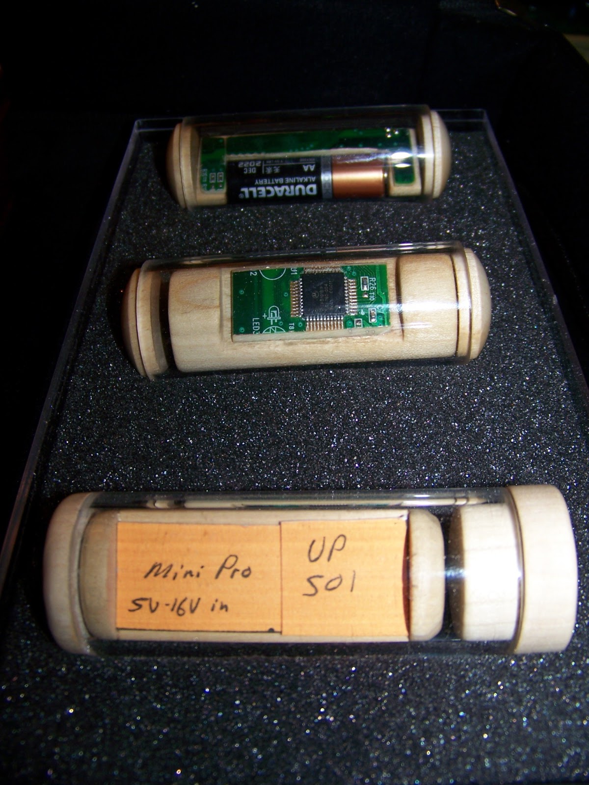
After reviewing many different design possibilities for the casing of the GPS data logging devices, I have settled on this general direction at least for the ramped-up trials I will be running with a few people. Some of the parameters I have set include:
* small enough to carry but big enough to keep track of
* unique enough to be interesting
* easily sourced materials
* scalable so that I can produce many of them
* economical so that they can be deployed in numbers
* waterproof
* modifiable
* capable of being turned on by research participants but not off
* materials that will enhance, not impair, satellite signals
* keep GPS antenna facing skyward
* won't roll off a table

With those parameters in mind, here is the first round of prototypes that use 0.125 inch wall thickness acrylic tubing (1 inch ID, 1.25 inch OD), waxed wood/cork and templates of the components. Wood protects against static and is easily worked with for prototypes and scaling up at moderate levels. The acrylic lets participants see what's inside, rather than going with a 'mysterious black box' approach. I can also include ID labels inside the tube where it will be protected but readable. The top two photos are prototyping sketches of a UP501 GPS module and an OpenLog SDmicro board where I'm experimenting with bypassing a microcontroller and writing direct from GPS to card - lower power use, increased simplicity, more compact size.